Mines, Oil, Chemicals.,
Air Pollution, Glacial Retreat
Go to: Rivers and Dams
Back to: Environment North America
Mines, Oil, Chemicals., Go to: Rivers and Dams Back to: Environment North America |
|
The signs of destruction on the surface are dramatic; what we don't see, except in its long-term effects, is the pollution of the air and water that goes with it. Why do our laws allow the corporations to get away with this? Why do we subsidize the oil industry, both in tax breaks and in paying the costs of their pollution and climate destruction? The results of their actions are passed on to all of us, and to the whole environment. |
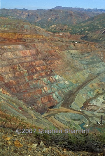
Image 1. A huge open-pit copper mine, the ASARCO "Ray Complex" south of Superior, Arizona. Photo from about 1991.
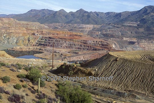
Image 2. A huge open-pit copper mine, the ASARCO "Ray Complex" south of Superior, Arizona. Photo from about 1991.
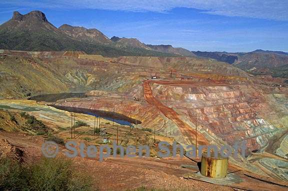
Image 3. A huge open-pit copper mine, the ASARCO "Ray Complex" south of Superior, Arizona. Photo from about 1991.
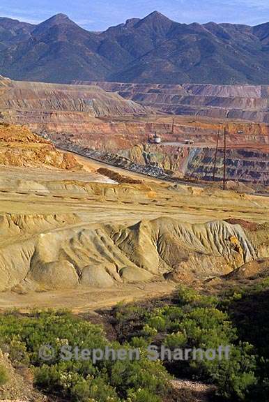
Image 4. A huge open-pit copper mine, the ASARCO "Ray Complex" south of Superior, Arizona. Photo from about 1991.
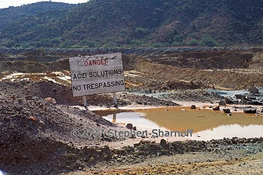
Image 5. A pond of toxic waste near the open-pit copper mine,
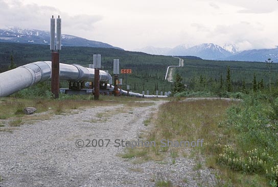
Image 6. The Alaska Pipeline. Ironically, the frozen ground, or permafrost
Image
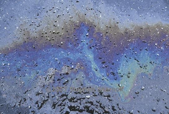
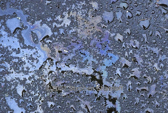
7. Oil on wet pavement in a parking lot, one of the costs
Image
8. Oil on wet pavement in a parking lot, one of the costs
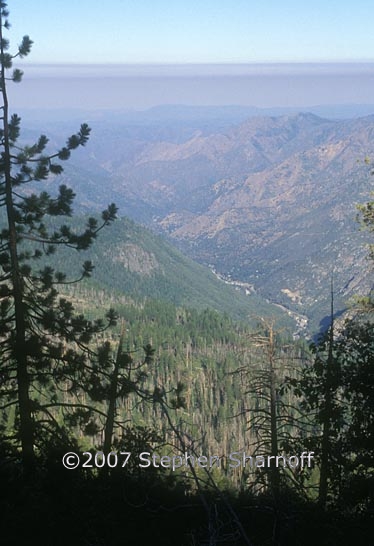
Image 9. Smog fills California's Central Valley
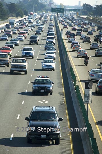
Image 10. A freeway in Berkeley, California. "Freeways" are not really free
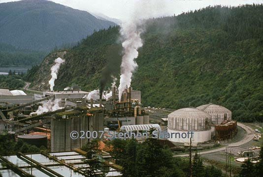
Image 11. A pulp mill in Sitka, Alaska, now closed. It was responsible for severe pollution of both air and water, as well as being a partner in the over-logging of Alaska's coastal forests. See the two images below for an example of the impact of this pollution on the lichens that live there.
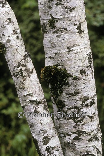
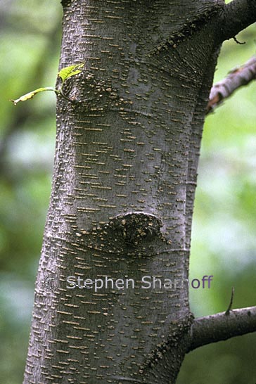
Image 12. An alder trunk with a mosaic of healthy white lichens in Sitka, Alaska, not far from the pulp mill in the previous photograph but in clean air.
Image 13. An alder trunk behind the pulp mill in Sitka, Alaska ,shown in the photograph above. The plume of pollution coming from the mill has killed all the lichens.
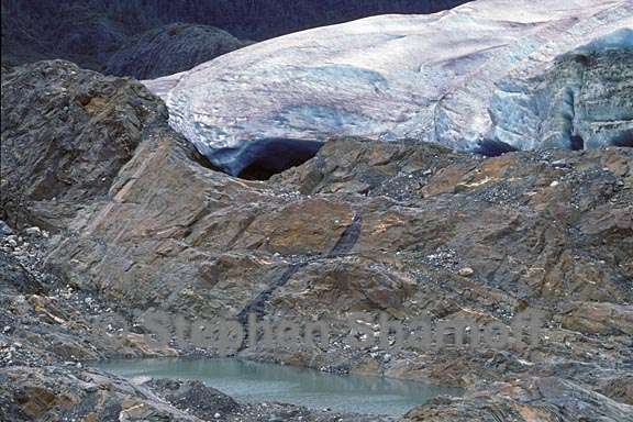
Image 14. The Mendenhall Glacier near Juneau, Alaska in 1990
Image 15. The Mendenhall Glacier near Juneau, Alaska in 1990
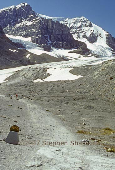
Image 16. The edge of the Athabaska Glacier in the Canadian Rockies. This photo was taken in 1990, and the sign marks the glacier's edge in 1960.
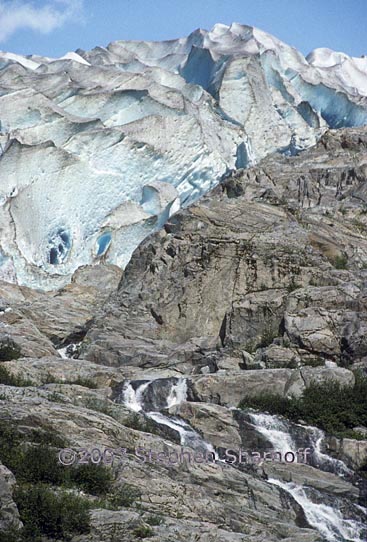
Image 17. The edge of the Herbert Glacier in coastal Alaska.|Like most glaciers in the world it's shrinking due to global warming, and the rock closest to the glacier is bare, without even lichens or mosses.
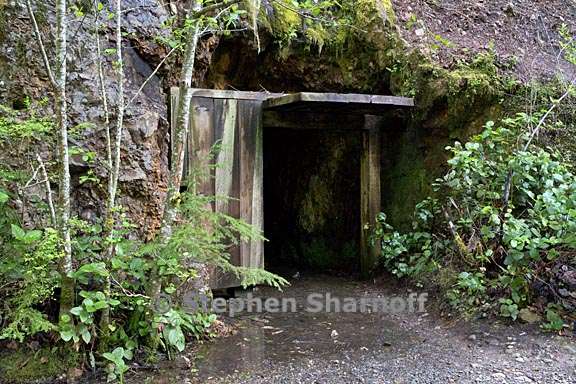
Image 18. An abandoned hardrock mining tunnel in the Opal Creek Sceni
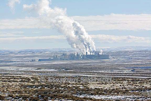
Image 19. A chemical plant visible from I-80 in Wyoming
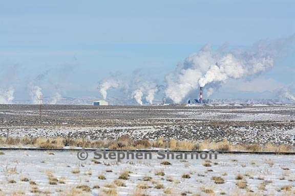
Image 20. A different chemical plant visible from I-80 in Wyoming |
|